After living in Congo-Brazzaville for a year, I finally had the opportunity to travel out of the capital city. I decided to go to Pointe Noire the economic capital and port city that is the country’s heartbeat. I had always heard of the country’s beautiful landscape, so I traveled by bus to enjoy the view. The bus ride from Brazzaville to Pointe Noire took about 8 hours (with rest stops) and covers a distance of 510 km.
I left my departure point in Brazzaville at 6 am and missed the first 2 to 3 hours of the scenery because I dozed off. There is something about the lull of buses that sends me to the clouds right away. I woke up to landscapes that changed every few minutes. It went from luteous green to grass-covered hills, to low grass almost savannah-like in some areas. A section of the road has sharp twists and turns that the body feels even in a large bus. It is in the midst of hills and forests where eyes glued to the window give a front view of mother nature’s green creations. During the trip, I remembered three rest stops in small towns and a city (Dolisie). There were always vendors selling an array of food and other items at the rest stops. The scenery was colorful with fruits, vegetables, and meat and noisy as sellers and buyers negotiated, conversed, and laughed with each other. What a way to see humanity.
The city of Pointe Noire initially got its name from the Spaniard who arrived and used a large black stone as a point of reference calling it Cabo-Negra. In the 15th century, the Portuguese arrived and called it Punta Negra. On May 19th, the French colonizer Pierre Savorgnan de Brazza arrived in the city, and through a treaty, the city came under French protectorate. The name is Portuguese was translated into French and we now know it as Pointe Noire. It became the main economic city as the port was a major hub for import and export. It was also a point where the wealth of all the countries in the Central African region (known as French Equatorial Africa in the 1900s) passed to go to France through the railway linking Pointe Noire to Brazzaville. To this day, the hustle and bustle of Pointe Noire showcases its business flair and portal city vibe. I spent days walking down the beaches and discovering the mixture of modern and colonial buildings in the large streets. In the city center, the original railway station still stands in the middle of the city reminiscent of its colonial days.
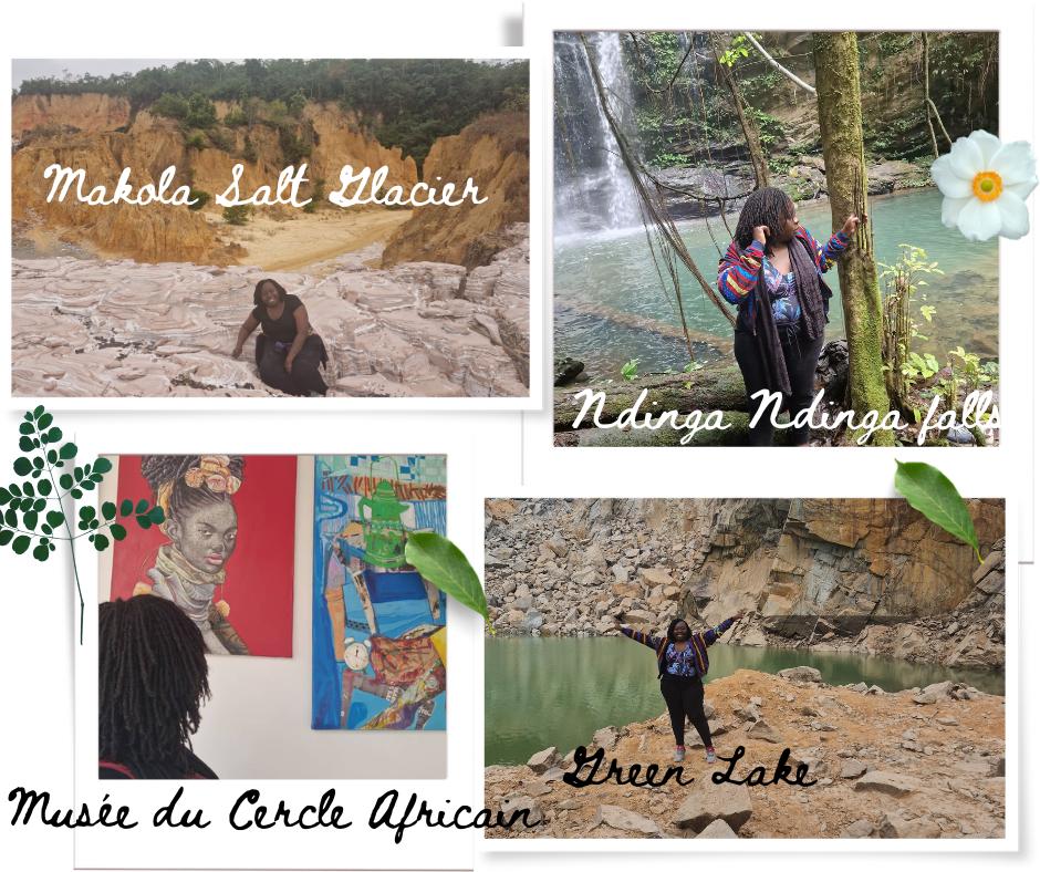
With the help of a local tourist guide, we planned an itinerary to three natural sites about 80 km drive from Pointe Noire. We took off at 7:45 in the morning and while crossing the city, I learned more about the historical points where the city began. For about 20 minutes we were out on the road with fewer buildings and just a view of fields and houses every few minutes. We passed through small villages and a larger town such as Hinda on the way. We then move out of the paved road into the reddish dirt road. The color of the roads reminded me of the southern part of my country. Soon we reached our first stop to take in nature’s beauty.
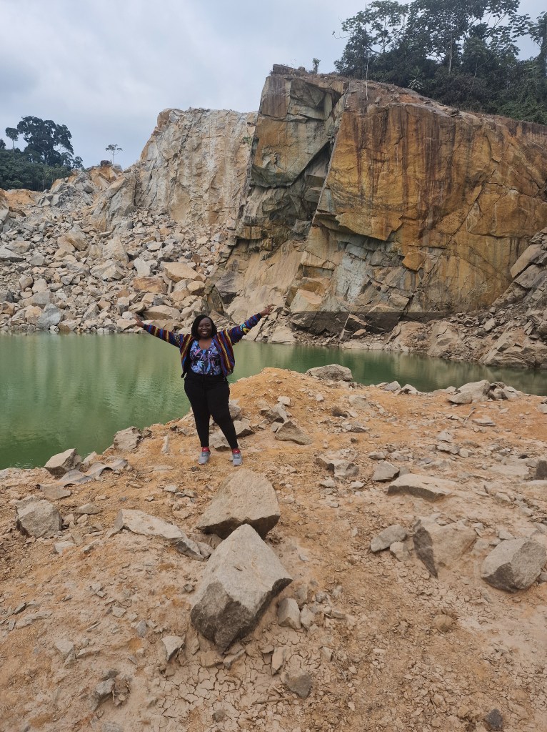
The green lake- From a main road we saw a green body of water nestled in the middle of high hills and rocks. The emerald color of the water comes from the minerals under the lake as well as from the surrounding rocks. There contrast of the green water, the gray rocks, the red road, and the greenery around is a picture-perfect landscape. As a mineral-rich country, green and blue lakes can be found in different parts.
Ndinga Ndinga Falls – from the lake we continued on the same road on our way to Kinanga village. We passed through villages such as Malele, and Luboulou. Once we arrive in Kinanga, we park in an area cleared out and used by locals as a soccer field. It is the entry point into the Kinanga forest where Ndinga Ndinga Falls is located. After security and safety guidelines were given by a group of local men, we were ready to begin our forest hike. The locals lead the way and one of them walked in the back for safety. I wanted to film the majority of the hike. With the phone in one hand, I captured the beauty of this dense forest while attempting to keep my balance. We were humans and foreign visitors making our way on a narrow path in Mother Earth’s ecosystem. At some point, I had put the phone away. The crackle of our footsteps on leaves was mixed with birds chirping and other noises we hoped were not dangerous animals. After about 20 minutes, we took off our shoes to cross a waterbed. The water was just around the calves, however the slippery stones required full attention. Not far from that bed we began to hear the rush of water and walked into a hidden waterfall with an emerald natural pool. Before anyone can touch the water, the locals have to do a ritual to ask the spiritual owners of the area for permission to swim there. We quietly watched as one of the local men poured wine and completed the ritual before telling us we could now swim. Tradition is tradition and I respect it. while silently watching, I also realized the importance of respecting nature as an entity. The middle of the pool has a depth of over 30 meters down and leads to rocks under the cooling water rush from the hill above. We spent about two hours in the area for those memory-keeping pictures before leaving to continue our exploration.
For some background, the Kinanga forest is part of the Mayombe forest which is a transfrontier area located in the Democratic Republic of Congo, Gabon, the Republic of Congo, and Angola (Cabinda enclave). The Mayombe is the second most biodiverse after the Amazon and home to gorillas, the giant pangolin amongst others. This is the reason why the Republic of Congo regularly hosts international conferences on biodiversity conservation. The latest one was held in October 2023 bringing together the representatives of the Amazon, Congo, and the Borneo-Mekong basins. It was indeed a humbling opportunity to spend time in the Mayombe.
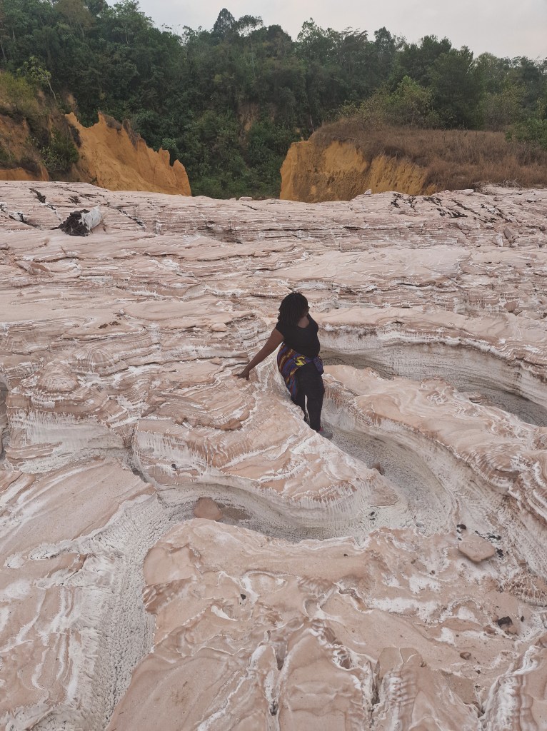
Salt Glacier of Makola – The last stop of our day trip was a salt deposit that sits by the bed of an ancient river that dried up. The area was previously used for potash mining by the Congo Potassium Company. The hill covered with salt rises to yellow and crimson-red hills. Beyond the hills lay green trees. While hiking up to the top of the hill, my friend and I got distracted by the vast amount of salt. Well after tasting it, we just sat down to collect some and take in the contrast of colors and the salty breeze. This was a great way to wind down and end our explorations. After about an hour of learning more about the mine and trying to understand how the river disappeared, we headed back to Pointe Noire.
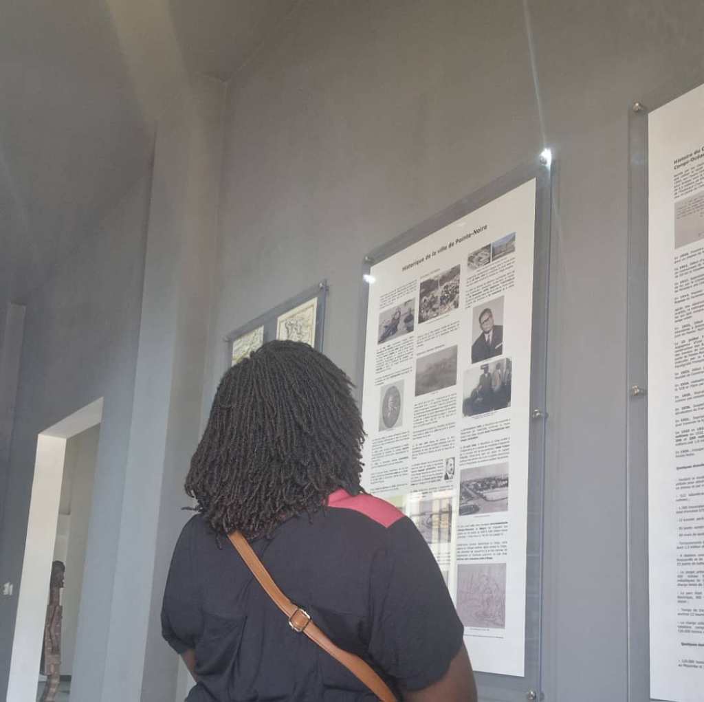
Musee du Cercle African- no trip to a new city or country would be complete for me without a visit to a museum. Tripadvisor’s highest recommendation was the Musée du Cercle Africain (African Circle Museum). I spent an afternoon there reading about the history of the country and the description of local ethnic traditions. The main entrance starts with the exposition of masks from different tribes with written explanations. The second room has a step-by-step history of the city, the railway, and colonization in the central African region with original pictures of the era. In the courtyard area, there was an exposition of a collective of artists from DRC called Bomoko meaning together in Lingala. I paced by the paintings twice taking in the talent and subtle details. It was a quiet way to end my adventures of the week in Pointe Noire and its surroundings.
Nature, history, humanity, and culture all wrapped up in one trip made memories that will last forever. I can now say that I lived and experienced the Republic of Congo and its beautiful complexities. I laughed with nationals and learned about their history, perspectives, and hopes. I have seen nature in its intact form breathing in pure air. The trip made me reflect on how Africa has it all. It is up to us to appreciate it and work towards building it.
Deborah Melom Ndjerareou

Leave a comment